Lesson 3: A Map to Get Lost
Lesson Number 3, Art 1, 2nd - 4th grade, 1-2 class periods
Elementary students are learning about their environment, community and local architecture and their own place within it. Engaging students with walking and mapping, students become aware of the process of embodied learning that they engage in when they navigate space. Students are introduced to using walking protocols to structure their experiences. Playing within public space, they learn about the ways that we create social spaces through interaction with community. Students will reflect on where they have access and who has ownership.
Key Concepts:
Maps can be directions to reach a destination as well as a record or narrative of an experience.
We navigate using maps and directions.
Maps translate our mental understanding of space with our physical experience.
Each person navigates and communicates spatial directions in unique ways.
Essential Question:
Lesson Objectives:
The student will be able to reflect on the ways we communicate navigation directions and the process of translating 3D space to 2D space by creating Maps to Get Lost, using Yoko Ono’s Map Instructions as an inspiration.
The student will be able to experiment with creating maps to imaginary locations and follow their maps, performing and executing a détournement of the local space of the school.
The Instructor will assess the students during the activity, based on student engagement and performance as well as after the activity during student-led discussion and reflection on the success of their instructional design.
Specific Art Content:
Students will reflect on observation, using different sense perceptions to notice the world around them.
Students will observe the process of composing or designing instructions for action.
Artists/Artwork: Yoko Ono, John Cage, Kevin Lynch
Resources & Materials for Teacher:
Power Point presentation
Computer or Tablet
Yoko Ono Map Instructions
Notepad or small books
Walking shoes
Pencil
Resources & Materials for Students:
Power Point presentation
Computer or Tablet
Yoko Ono Map Instructions
Notepad or small books
Walking shoes
Pencil
Instruction and Sequencing:
Introduction/Motivation:
Instructor will read Yoko Ono Prompt – students will discuss impossible maps, fantasy maps and treasure maps.
Instructor will introduce the ideas of the Situationist International of dérive and détournement.
Instructor will ask students to discuss the parameters of getting lost. How is technology changing the ways that we navigate?
Guided Practice:
Instructor will guide students in creating imaginary maps in groups of three. Instructor will demonstrate the Yoko Ono activity using the classroom as an example. Students are shown examples of alternative mappings – Australian aboriginal paintings, Situationist International map collages, Jorge Macchi sculptural maps.
Independent Practice:
Students will return to the classroom and discuss the ways that they followed or didn’t follow the directions.
Students will share their notations from their trips and compare them to the directions they followed.
Formative Evaluation:
Instructor will use the guided and independent practice time to assess student comprehension and application. Depending on performance, Instructor will slow or speed up demonstration and practice.
Classroom Management Procedures:
At first, it is advised to use the school campus for this activity, setting a limit that students cannot go past. Students can be paired up for this activity.
Summative Assessment and Evaluation:
Summative assessment is based on the maps they create, participation in activity and reflection during discussion.
Interdisciplinary Connections:
History, Architecture, Science, Political Science
Lesson Number 3, Art 1, 2nd - 4th grade, 1-2 class periods
Elementary students are learning about their environment, community and local architecture and their own place within it. Engaging students with walking and mapping, students become aware of the process of embodied learning that they engage in when they navigate space. Students are introduced to using walking protocols to structure their experiences. Playing within public space, they learn about the ways that we create social spaces through interaction with community. Students will reflect on where they have access and who has ownership.
Key Concepts:
Maps can be directions to reach a destination as well as a record or narrative of an experience.
We navigate using maps and directions.
Maps translate our mental understanding of space with our physical experience.
Each person navigates and communicates spatial directions in unique ways.
Essential Question:
- How do we navigate our world?
- How do we communicate directions?
- How do we map place? How do we map experience?
- How do we construct meaning and narrate experiences within place?
- Where do we feel at home?
- Where do we have access to and where can we not go?
Lesson Objectives:
The student will be able to reflect on the ways we communicate navigation directions and the process of translating 3D space to 2D space by creating Maps to Get Lost, using Yoko Ono’s Map Instructions as an inspiration.
The student will be able to experiment with creating maps to imaginary locations and follow their maps, performing and executing a détournement of the local space of the school.
The Instructor will assess the students during the activity, based on student engagement and performance as well as after the activity during student-led discussion and reflection on the success of their instructional design.
Specific Art Content:
Students will reflect on observation, using different sense perceptions to notice the world around them.
Students will observe the process of composing or designing instructions for action.
Artists/Artwork: Yoko Ono, John Cage, Kevin Lynch
Resources & Materials for Teacher:
Power Point presentation
Computer or Tablet
Yoko Ono Map Instructions
Notepad or small books
Walking shoes
Pencil
Resources & Materials for Students:
Power Point presentation
Computer or Tablet
Yoko Ono Map Instructions
Notepad or small books
Walking shoes
Pencil
Instruction and Sequencing:
Introduction/Motivation:
Instructor will read Yoko Ono Prompt – students will discuss impossible maps, fantasy maps and treasure maps.
Instructor will introduce the ideas of the Situationist International of dérive and détournement.
Instructor will ask students to discuss the parameters of getting lost. How is technology changing the ways that we navigate?
Guided Practice:
Instructor will guide students in creating imaginary maps in groups of three. Instructor will demonstrate the Yoko Ono activity using the classroom as an example. Students are shown examples of alternative mappings – Australian aboriginal paintings, Situationist International map collages, Jorge Macchi sculptural maps.
Independent Practice:
- Students will draw maps with direction to a secret imaginary place or secret location..
- Students will attempt to reach the imaginary goal, in the real world.
- Working in pairs, students will take turns notating each movement and recording the experience, look and feeling of the places they pass through.
Students will return to the classroom and discuss the ways that they followed or didn’t follow the directions.
Students will share their notations from their trips and compare them to the directions they followed.
Formative Evaluation:
Instructor will use the guided and independent practice time to assess student comprehension and application. Depending on performance, Instructor will slow or speed up demonstration and practice.
Classroom Management Procedures:
At first, it is advised to use the school campus for this activity, setting a limit that students cannot go past. Students can be paired up for this activity.
Summative Assessment and Evaluation:
Summative assessment is based on the maps they create, participation in activity and reflection during discussion.
Interdisciplinary Connections:
History, Architecture, Science, Political Science
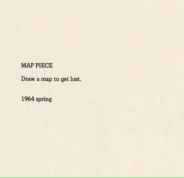
Yoko Ono, 1964, Map Piece
|
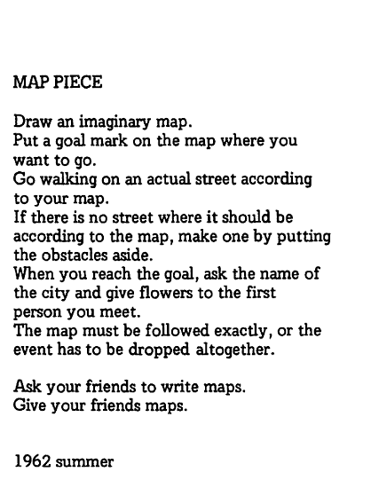
Yoko Ono, Map Piece, 1962
|